This content was generated using artificial intelligence based on publicly available information. It is provided for general informational purposes only and does not constitute legal, tax, immigration, or professional advice. Information may be incomplete or outdated. Always verify with official sources before making decisions.
Data Source: Safety, crime, and quality metrics are sourced from Numbeo, a crowd-sourced global database of reported data.
All scores are relative comparisons on a 0-100 scale, where 50 = global average. Higher scores mean better than average, lower scores mean worse than average.
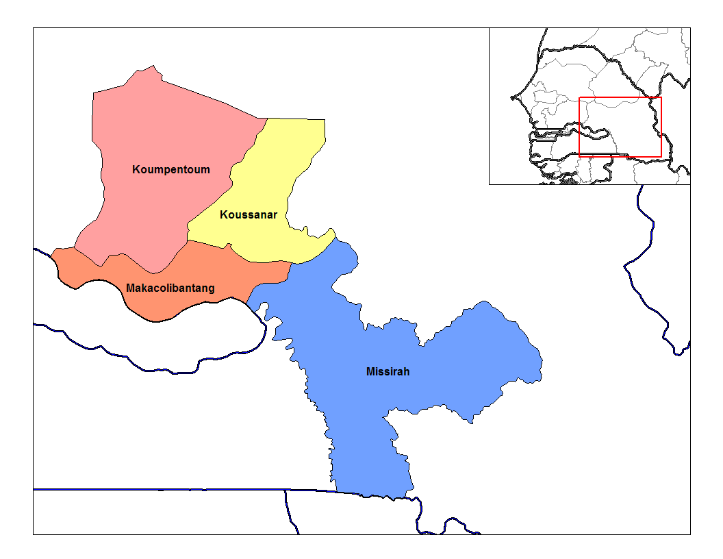
Rarelibra, using MapInfo Professional v8.5 and various mapping resources.•Public domain
TambacoundaSenegal
City Overview of Tambacounda
Tambacounda offers a rugged, authentic gateway to eastern Senegal, appealing primarily to those seeking a slower pace of life far from the coastal bustle of Dakar. It is a strategic hub for professionals working in regional development or NGOs, providing a grounded lifestyle centered around local commerce and community connection.
While the city offers reliable access to essential healthcare and functional public transport, the reality is one of significant heat and a more modest infrastructure. You will find a manageable cost of living, but the lack of established expat enclaves means you must be comfortable with a high degree of self-reliance and a more traditional, less Westernized daily routine.
Population
89,212
Area
1,733 km²
Density
51 per km²
Founded
-
Language
French
Distance to Coast
184 km
Districts & Neighborhoods in Tambacounda
Loading districts…
Climate & Weather in Tambacounda
Tambacounda has a **tropical savanna (Aw)** climate with a long dry season from November to May and a rainy season from June to October. It is very hot for much of the year, with peak heat before the rains, and annual rainfall is moderate for Senegal at around 887 mm. The current conditions of warm temperatures and broken clouds are consistent with the city’s generally hot, sunny climate.
Summer Average
32°C
Winter Average
24°C
Climate Type
Tropical Savanna
Rainy Days
78
Sunny Days
290
Humidity
55%
Spring
March - May
30-39°C
Spring is the hottest stretch of the year, with intense daytime heat and increasing humidity as the rainy season approaches. Heat stress can be significant, especially in April and May.
Low rainfall
Summer
June - August
27-34°C
Summer is the core rainy season, bringing frequent showers and thunderstorms, though hot conditions persist between rains. Humidity is higher and the landscape is greener than in the dry season.
High rainfall
Autumn
September - November
26-35°C
Autumn starts wet in September and then turns progressively drier and sunnier through October and November. Temperatures remain high, but humidity drops as the dry season begins.
Moderate rainfall
Winter
December - February
20-32°C
Winter is the dry season, with abundant sunshine, low rainfall, and noticeably lower humidity. Nights and early mornings are cooler than in the pre-rainy season, but afternoons still feel warm to hot.
Very Low rainfall
Loading Weather...
Air Quality
Tambacounda
Advantages
Tambacounda
Rich cultural heritage sites
Extensive school network
Affordable cost of living
Gateway to Senegal's interior
Strong community bonds
Growing regional hub
Disadvantages
Tambacounda
Limited higher education options
Few coworking spaces available
Scarce job opportunities
Basic infrastructure development
Limited entertainment venues
Safety & Security in Tambacounda
Overall Safety Score
Includes resilience and environmental factors
Moderate
55
/100
Senegal Avg
54
Africa Avg
54
Worldwide Avg
56
Crime & Safety Metrics
Thermometer compares Tambacounda to Senegal averages using different marker styles.Compare:
Tambacounda
Senegal Average
No city-specific data available — showing Senegal country averages instead.
Safety Index
0510
Moderate
Safety from Crime
0510
Moderate
Safe Alone (Day)
0510
Moderate
Safe Alone (Night)
0510
Low
Safety from Violent Crime
0510
Moderate
Safety from Property Crime
0510
Concerning
Environmental & Natural Hazard Risks
Resilience Score: N/A
Data Currently Under Investigation
Environmental risk assessments are being researched. The indicators below show what data will be available soon.